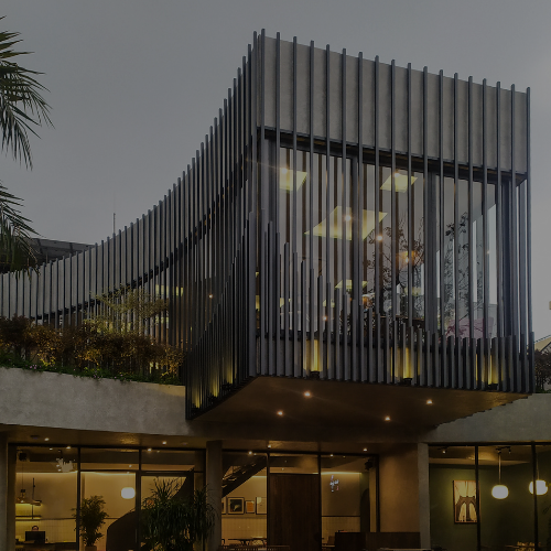
Ft: Private residence
Civil Engineering Services in San Jose & the Bay Area
At Osuna Civil Engineering Inc., we deliver innovative, precise, and sustainable civil engineering solutions for residential, commercial, and land development projects throughout San Jose, Santa Clara County, and the greater Bay Area. Our licensed engineers combine decades of local expertise with cutting-edge technology to help you navigate every stage of your project — from concept to completion — efficiently, compliantly, and cost-effectively.
Full Services
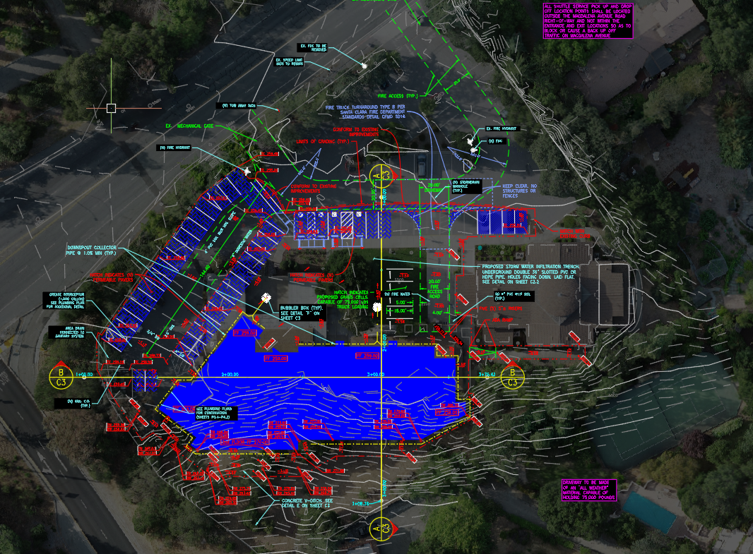
Grading and Drainage Plans
We design precise grading and drainage plans to ensure proper water flow, prevent flooding, and protect your property from erosion while meeting local permitting requirements.
Utility Plans
Our utility plans map out water, sewer, gas, and electrical systems, ensuring seamless integration with your site’s design and compliance with city infrastructure standards.
Erosion & Sedimentation Control Plans
We create erosion and sedimentation control plans to safeguard construction sites from soil loss, control stormwater runoff, and meet environmental regulations.
Storm Water Control Plans
Our stormwater control plans protect waterways by managing runoff, reducing pollution, and ensuring compliance with state and municipal stormwater management laws.
Public Improvement Plans
We prepare public improvement plans for roads, sidewalks, utilities, and other infrastructure required by local municipalities for new developments.
Private Improvement Plans
Our private improvement plans focus on site-specific infrastructure such as driveways, parking lots, and drainage systems for residential and commercial properties.
Hydraulic & Hydrology Calculations
We perform hydraulic and hydrology calculations to analyze water flow, drainage capacity, and flood risks, ensuring your project meets safety and regulatory standards.
Land Planning
Our land planning services help developers maximize property use while meeting zoning, environmental, and community requirements for sustainable growth.
Subdivision Tentative Map
We prepare subdivision tentative maps that outline property divisions, infrastructure placement, and compliance with local subdivision regulations.
HEC-RAS Analysis
Using HEC-RAS modeling, we analyze river, creek, and floodplain hydraulics toassess water behavior and design flood mitigation measures.
Creek Flood Plain Studies
Our creek floodplain studies determine flood risks, guide development near waterways, and help secure FEMA and local flood compliance.
Annexations
We provide annexation services to integrate properties into city limits, navigating the technical, legal, and engineering requirements for approval.
Send Request
Frequently Asked Questions
What are Grading and Drainage Plans, and why are they necessary for a construction project?
Grading and Drainage Plans outline the surface of the property directing the water runoff from impervious and pervious surfaces away from structures to avoid flooding and erosion issues. It is necessary when a construction project requires grading that will change the waterflow along the surface of the property, so that. We specialize in Low Impact Design (L.I.D.) and mitigate for any excess runoff created by the proposed development
What is the purpose of Utility Plans, and how do they contribute to the overall project design?
A Utility Plan shows the location, route, size, and points of connection of essential utilities that are needed for the new development.
Can you explain Erosion & Sedimentation Control Plans and their significance in construction projects?
Erosion and Sedimentation Control Plans are plans that outline measures for the Construction Contractor to minimize environmental impacts of sediment runoff and prevent erosion during or after construction activities.
What role do Storm Water Control Plans play in preventing environmental damage and ensuring regulatory compliance?
A Storm Water Control Plan outlines measures and Best Management Practices (BMPs) for sources of control to mitigate pollution, flooding, and erosion due to water runoff from the project site in coordination with regulatory compliance.
What are Public Improvement Plans, and when are they required in a development project?
Public Improvement Plans show construction of utilities, streets, drainage within the public Right Of Way or Public infrastructures within easements in private property. They are required when a project design for a site needs to seamlessly connect into the existing public infrastructure.
What are Hydraulic & Hydrology Calculations, and why are they crucial for project design and safety?
Hydraulic & Hydrology Calculations are calculations of the water flow and volume of water runoff produced from rainfall. They are crucial for ensuring the calculated water volume/runoff from rainfall is mitigated with necessary storm water control facilities to avoid flooding.